01925 813211
info@irishseaconservation.org.uk
 Primary links
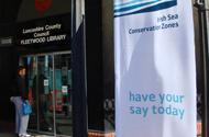
Interactive map launches
Submitted by iscz on Fri, 06/18/2010 - 14:06Our new interactive map makes it easier for you to tell us which parts of the Irish Sea are important to you.
The map has been specially developed for the national Marine Conservation Zone Project, a partnership which is working with people who use and enjoy the sea, whether for their livelihood or for leisure.
The map aims to give an insight into how the sea is being used, as well as add to what we know about the animals, plants and habitats in our seas.
Anyone who uses the sea is invited to add their information to it and people can take part in two ways.
They can upload information about their marine activities, and the location of marine wildlife, notable habitats and geological features they have seen.
Or they can look discover more about their region’s sea by looking at the layers of data out of personal interest.
The information gathered via the interactive map will be taken into consideration as areas of the sea are recommended for a new type of marine protection called Marine Conservation Zones.
These new zones will conserve nationally important marine species and habitats, and will become part of a network of marine protected areas that the UK is committed to establishing by 2012.
All data will be analysed and will inform recommendations for potential Marine Conservation Zones, as part of the work being delivered by four regional projects, covering the south-east (Balanced Seas), south-west (Finding Sanctuary), Irish Sea (Irish Sea Conservation Zones) and North Sea (Net Gain).
Recommendations about the size, shape and location of Marine Conservation Zones in the Irish Sea project area are being developed by a group of 40 people called the regional stakeholder group. Everyone on the group has a special interest in the Irish Sea.
Information about the Irish Sea that is collected via the new interactive map will be supplied to the stakeholder group. The group can then take into account which areas of the Irish Sea are especially important.
Tom Hooper, project manager of Finding Sanctuary, said: “All of us involved with the MCZ Project want to ensure that these important decisions are based on the best data; not just from marine industries, but from individuals who use the sea.
“Together with information from face-to-face interviews that all four regional MCZ projects have been conducting, it will help to build up a detailed picture of the ecological value and use of our seas.”
“It’s easy to use – you follow a series of simple steps showing you how to upload your information onto the map, or how to just browse and have a look around.
“It is a window into what exists under the waves, easily accessed from a computer, without having to don a wetsuit and mask.”
“It’s easier to obtain data from sectors that have a national body, for example, the cables industry. But it is more difficult to collect information on activities such as sea angling, diving and other recreational activities as they are more dispersed.
“It is crucial that people get involved at this stage so their voices can be heard.”
The interactive map is at www.mczmapping.org and the deadline for uploading data is 30 September 2010.
Feature:
Featured